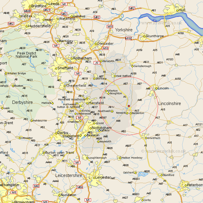
Nottinghamshire Map Showing Location of Holme
Population: 77
District: Newark and Sherwood
Easting: 480305 Northing: 358429
Latitude: 53.12 Longitude: -0.8
 = Holme
District: Newark and Sherwood
Easting: 480305 Northing: 358429
Latitude: 53.12 Longitude: -0.8
= Holme
This Holme map below is supplied by Google. Use the tools in the top left corner to zoom into street level or zoom out for a road map, you may also need to zoom in to see Holme on the map. Click and drag the map to move around. If the map fails to load try and refresh your browser or zoom in or out (+ or -).
Update - it seems Google no longer allow people to use their maps for free! This Holme map sometimes loads and sometimes gives a error. I am working on a solution.
Closest 30 Towns or Cities to Holme (Population over 500)
North Muskham 1.11km Muskham 1.11km Winthorpe 2.16km Collingham 4.99km North Collingham 4.99km Coddington 4.99km Balderton 5.67km Newark 5.67km Newark upon Trent 5.67km Newark on Trent 5.67km Newark-on-Trent 5.67km Farndon 8.13km Fiskerton 9.98km Fiskerton Ferry 9.98km Southwell 11.45km Elston 11.98km Tuxford 12.43km Bleasby 12.86km Bilsthorpe 15.68km Farnsfield 15.68km Markham 15.83km East Markham 15.83km Boughton 15.87km Flintham 16.27km Walesby 17.82km Ollerton 18.23km Edwinstowe 19.26km Oxton 19.29km East Bridgford 19.46km Elkesley 20.04km