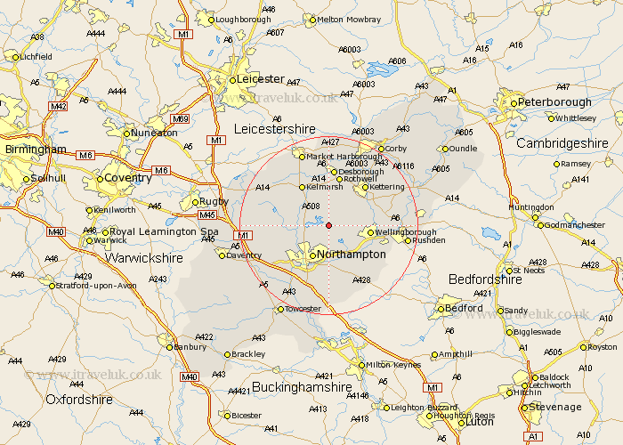
Northamptonshire Map Showing Location of Holcot
Population: 399
District: Daventry
Easting: 479516 Northing: 269416
Latitude: 52.32 Longitude: -0.83
 = Holcot
District: Daventry
Easting: 479516 Northing: 269416
Latitude: 52.32 Longitude: -0.83
= Holcot
This Holcot map below is supplied by Google. Use the tools in the top left corner to zoom into street level or zoom out for a road map, you may also need to zoom in to see Holcot on the map. Click and drag the map to move around. If the map fails to load try and refresh your browser or zoom in or out (+ or -).
Update - it seems Google no longer allow people to use their maps for free! This Holcot map sometimes loads and sometimes gives a error. I am working on a solution.
Closest 30 Towns or Cities to Holcot (Population over 500)
Walgrave 2.17km Pitsford 3.87km Overstone 3.88km Moulton 3.88km Brixworth 4.53km Sywell 5.04km Boughton 5.86km Broughton 7.17km Billing 7.5km Great Billing 7.5km Spratton 7.93km Northampton 8.16km Wellingborough 9.25km Earls Barton 9.34km Wilby 9.69km Isham 9.79km Doddington 10.64km Great Doddington 10.64km Whiston 10.87km Great Houghton 11.12km Houghton 11.12km Rothwell 11.35km Rowell 11.35km Guilsborough 11.48km Burton Latimer 11.91km Kettering 12.19km Naseby 12.6km East Haddon 12.6km Desborough 13.01km Hardingstone 13.41km