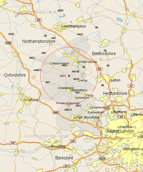
Buckinghamshire Map Showing Location of Hoggeston
Population: 105
District: Aylesbury Vale
Easting: 481377 Northing: 224951
Latitude: 51.92 Longitude: -0.82
 = Hoggeston
District: Aylesbury Vale
Easting: 481377 Northing: 224951
Latitude: 51.92 Longitude: -0.82
= Hoggeston
This Hoggeston map below is supplied by Google. Use the tools in the top left corner to zoom into street level or zoom out for a road map, you may also need to zoom in to see Hoggeston on the map. Click and drag the map to move around. If the map fails to load try and refresh your browser or zoom in or out (+ or -).
Update - it seems Google no longer allow people to use their maps for free! This Hoggeston map sometimes loads and sometimes gives a error. I am working on a solution.
Closest 30 Towns or Cities to Hoggeston (Population over 500)
Mursley 1.85km Whitchurch 3.89km Whitechurch 3.89km Stewkley 4.57km Winslow 5.05km North Marston 5.06km Great Horwood 6.53km Newton Longville 6.53km Soulbury 7.1km Stoke Hammond 7.79km Wing 7.8km Quainton 8.83km Bletchley 9.35km Great Brickhill 9.86km Shenley Brook End 9.88km Thornborough 10.09km Padbury 10.7km Aylesbury 11.18km Shenley Church End 11.35km Shenley 11.35km Waddesdon 11.54km Claydon 11.58km Steeple Claydon 11.58km Milton Keynes 11.98km Bow Brickhill 12.67km Bradwell 13.16km Stone 13.18km Simpson 13.69km Gawcott 13.74km Grendon Underwood 13.75km