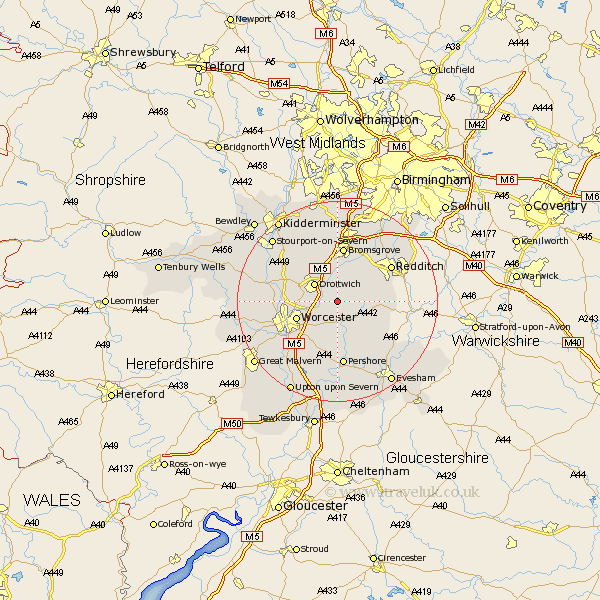
Worcestershire Map Showing Location of Himbleton
Population: 415
District: Wychavon
Easting: 394309 Northing: 259503
Latitude: 52.23 Longitude: -2.08
 = Himbleton
District: Wychavon
Easting: 394309 Northing: 259503
Latitude: 52.23 Longitude: -2.08
= Himbleton
This Himbleton map below is supplied by Google. Use the tools in the top left corner to zoom into street level or zoom out for a road map, you may also need to zoom in to see Himbleton on the map. Click and drag the map to move around. If the map fails to load try and refresh your browser or zoom in or out (+ or -).
Update - it seems Google no longer allow people to use their maps for free! This Himbleton map sometimes loads and sometimes gives a error. I am working on a solution.
Closest 30 Towns or Cities to Himbleton (Population over 500)
Crowle 4.34km Hanbury 4.35km Droitwich 5.86km Feckenham 7.06km Stoke Prior 7.5km Fernhill Heath 7.95km Bishampton 8.69km Inkberrow 8.77km Worcester 8.77km Peopleton 9.33km Astwood Bank 10.38km Ombersley 10.87km Bromsgrove 11.18km Grimley 11.35km Holt 11.5km Hallow 11.5km Redditch 12.62km Radditch 12.62km Church Lench 12.98km Pershore 13.02km Great Dodford 13.03km Dodford 13.03km Powick 13.56km Kempsey 13.67km Wadborough 13.74km Fladbury 13.74km Chaddesley Corbett 14.16km Alvechurch 14.35km Barnt Green 14.65km Lickey 15.01km