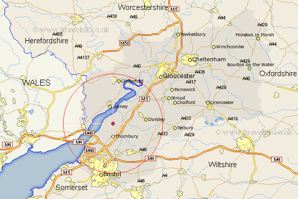
Gloucestershire Map Showing Location of Hill
Population: 114
Easting: 364257 Northing: 194756
Latitude: 51.65 Longitude: -2.52
 = Hill
Easting: 364257 Northing: 194756
Latitude: 51.65 Longitude: -2.52
= Hill
This Hill map below is supplied by Google. Use the tools in the top left corner to zoom into street level or zoom out for a road map, you may also need to zoom in to see Hill on the map. Click and drag the map to move around. If the map fails to load try and refresh your browser or zoom in or out (+ or -).
Update - it seems Google no longer allow people to use their maps for free! This Hill map sometimes loads and sometimes gives a error. I am working on a solution.
Closest 30 Towns or Cities to Hill (Population over 500)
Stone 3.45km Falfield 4.96km Thornbury 5.56km Alveston 5.68km Berkeley 5.9km Cromhall 5.91km Tytherington 6.02km Lydney 7.51km Charfield 7.83km Woolaston 8km Olveston 8.18km Aust 8.86km Tidenham 9.2km North Nibley 9.38km Rangeworthy 10.34km Bream 11.64km Almondsbury 11.64km Iron Acton 11.64km Wotton under Edge 11.65km Wotton-under-Edge 11.65km Slimbridge 11.81km Wickwar 11.82km Cam 12.77km Dursley 12.78km Winterbourne 12.87km Frampton Cotterell 13.18km Patchway 13.43km Pilning 13.73km Awre 14.19km Uley 14.28km