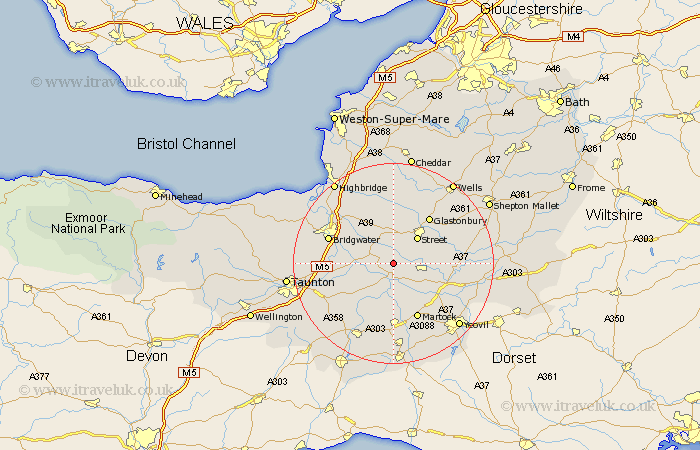
Somerset Map Showing Location of High Ham
Population: 786
District: South Somerset
Easting: 342782 Northing: 130083
Latitude: 51.07 Longitude: -2.82
 = High Ham
District: South Somerset
Easting: 342782 Northing: 130083
Latitude: 51.07 Longitude: -2.82
= High Ham
This High Ham map below is supplied by Google. Use the tools in the top left corner to zoom into street level or zoom out for a road map, you may also need to zoom in to see High Ham on the map. Click and drag the map to move around. If the map fails to load try and refresh your browser or zoom in or out (+ or -).
Update - it seems Google no longer allow people to use their maps for free! This High Ham map sometimes loads and sometimes gives a error. I am working on a solution.
Closest 30 Towns or Cities to High Ham (Population over 500)
Langport 3.89km Othery 5.01km Somerton 5.02km Walton 6.57km Long Sutton 6.57km Middlezoy 6.9km Street 7.25km Curry Rivel 7.25km Ashcott 7.5km Shapwick 7.5km Compton 7.91km Stoke St. Gregory 8.96km Stoke Saint Gregory 8.96km Stoke St Gregory 8.96km Kingsbury Episcopi 9.35km Kingsbury 9.35km Weston Zoyland 9.86km Butleigh 10.02km Fivehead 10.19km Charlton Mackrell 10.48km Meare 11.36km Cossington 11.6km North Curry 11.87km Glastonbury 11.89km Ilchester 11.91km Martock 12.06km Barton Saint David 12.22km Barton St. David 12.22km Barton St David 12.22km Yeovilton 12.85km