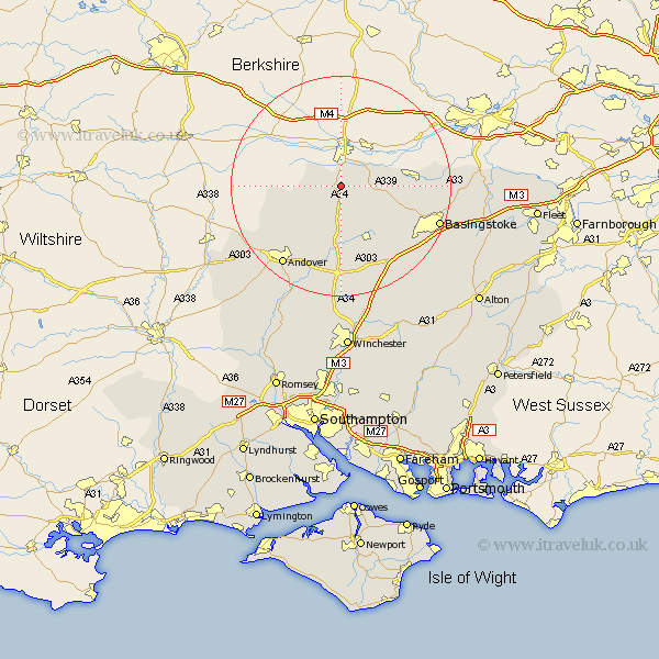
Hampshire Map Showing Location of Highclere
Population: 2816
Area Size (ha): 123
District: Basingstoke and Deane
Easting: 446439 Northing: 159623
Latitude: 51.33 Longitude: -1.33
 = Highclere
Area Size (ha): 123
District: Basingstoke and Deane
Easting: 446439 Northing: 159623
Latitude: 51.33 Longitude: -1.33
= Highclere
This Highclere map below is supplied by Google. Use the tools in the top left corner to zoom into street level or zoom out for a road map, you may also need to zoom in to see Highclere on the map. Click and drag the map to move around. If the map fails to load try and refresh your browser or zoom in or out (+ or -).
Update - it seems Google no longer allow people to use their maps for free! This Highclere map sometimes loads and sometimes gives a error. I am working on a solution.
Closest 30 Towns or Cities to Highclere (Population over 500)
Burghclere 2.18km Ecchinswell 4.63km Kingsclere 6.08km East Woodhay 6.08km Hurstbourne Tarrant 10.98km Baughurst 11.58km Overton 12.54km Whitchurch 12.97km Vernhams Dean 13.27km Vernham Dean 13.27km Oakley 13.95km Tadley 14.02km Tangley 14.74km Longparish 17.31km North Waltham 18.13km Andover 18.13km Silchester 18.61km Bramley 18.62km Barton Stacey 18.67km Basingstoke 18.89km Dummer 19.55km Upper Clatford 19.68km Wonston 20.41km Abbotts Ann 21km Abbots Ann 21km Clatford 21.26km Goodworth Clatford 21.26km Lower Clatford 21.26km Chilbolton 21.54km Basing 22.13km