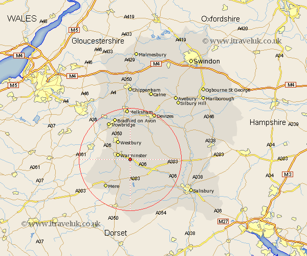
Wiltshire Map Showing Location of Heytesbury
Population: 696
District: West Wiltshire
Easting: 391846 Northing: 142738
Latitude: 51.18 Longitude: -2.12
 = Heytesbury
District: West Wiltshire
Easting: 391846 Northing: 142738
Latitude: 51.18 Longitude: -2.12
= Heytesbury
This Heytesbury map below is supplied by Google. Use the tools in the top left corner to zoom into street level or zoom out for a road map, you may also need to zoom in to see Heytesbury on the map. Click and drag the map to move around. If the map fails to load try and refresh your browser or zoom in or out (+ or -).
Update - it seems Google no longer allow people to use their maps for free! This Heytesbury map sometimes loads and sometimes gives a error. I am working on a solution.
Closest 30 Towns or Cities to Heytesbury (Population over 500)
Warminster 5km Codford 5.94km Longbridge Deverill 6.1km Dilton 8.04km Westbury 8.75km Bratton 9.27km Hindon 9.33km Edington 9.35km Corsley 10km West Lavington 11km Erlestoke 11.65km Steeple Ashton 13.03km North Bradley 13.12km Tisbury 13.17km Bishop's Knoyle 13.43km East Knoyle 13.43km Southwick 13.77km Longford 13.94km Steeple Langford 13.94km Market Lavington 14.49km Lavington 14.49km Mere 14.5km Dinton 14.5km Shrewton 15.1km Worton 15.24km Hilperton 15.54km Potterne 16.39km Zeal 16.75km Zeals 16.75km Semley 16.84km