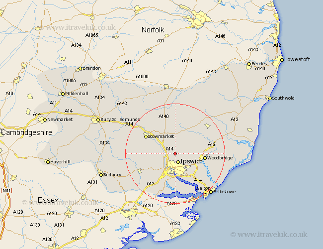
Suffolk Map Showing Location of Henley
Population: 546
District: Mid Suffolk
Easting: 615639 Northing: 251213
Latitude: 52.12 Longitude: 1.15
 = Henley
District: Mid Suffolk
Easting: 615639 Northing: 251213
Latitude: 52.12 Longitude: 1.15
= Henley
This Henley map below is supplied by Google. Use the tools in the top left corner to zoom into street level or zoom out for a road map, you may also need to zoom in to see Henley on the map. Click and drag the map to move around. If the map fails to load try and refresh your browser or zoom in or out (+ or -).
Update - it seems Google no longer allow people to use their maps for free! This Henley map sometimes loads and sometimes gives a error. I am working on a solution.
Closest 30 Towns or Cities to Henley (Population over 500)
Coddenham 2.93km Wirnesham 2.94km Witnesham 2.94km Ipswich 3.89km Great Blakenham 3.89km Claydon 4.36km Bramford 6.53km Otley 6.79km Grundisburgh 7.08km Somersham 7.08km Sproughton 8.17km Sprughton 8.17km Hintlesham 10.08km Martlesham Heath 10.67km Martlesham 10.9km Debenham 11.35km Great Bricett 11.38km Bucklesham 11.52km Ringshall 11.53km Melton 11.53km Woodbridge 11.53km Nacton 12.49km Stowmarket 13.57km Ufford 13.66km Capel 14.17km Capel St. Mary 14.17km Capel Saint Mary 14.17km Capel St Mary 14.17km Old Newton 14.36km Sutton 14.75km