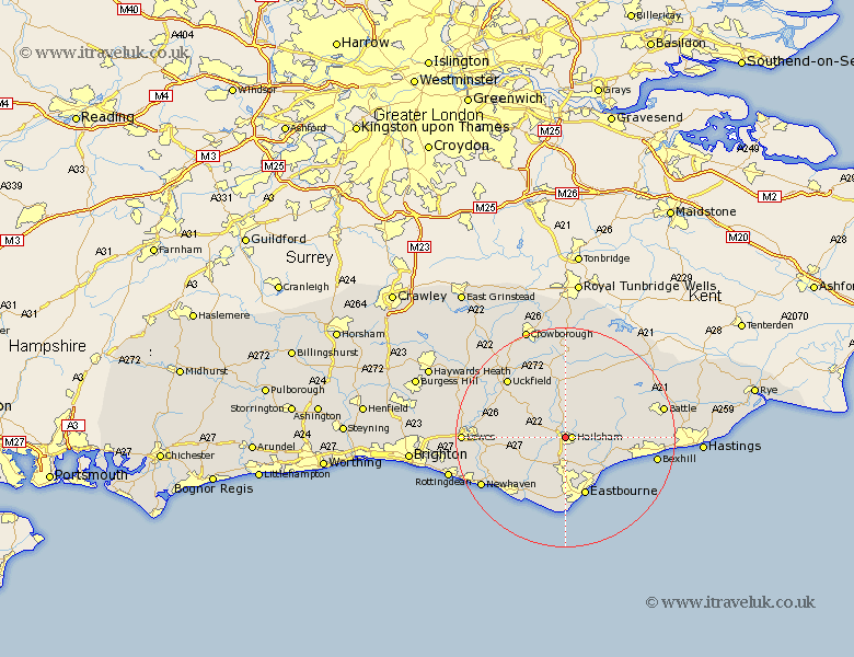
Sussex Map Showing Location of Hellingly
Population: 1447
District: Wealden
Easting: 558310 Northing: 109939
Latitude: 50.87 Longitude: 0.25
 = Hellingly
District: Wealden
Easting: 558310 Northing: 109939
Latitude: 50.87 Longitude: 0.25
= Hellingly
This Hellingly map below is supplied by Google. Use the tools in the top left corner to zoom into street level or zoom out for a road map, you may also need to zoom in to see Hellingly on the map. Click and drag the map to move around. If the map fails to load try and refresh your browser or zoom in or out (+ or -).
Update - it seems Google no longer allow people to use their maps for free! This Hellingly map sometimes loads and sometimes gives a error. I am working on a solution.
Closest 30 Towns or Cities to Hellingly (Population over 500)
Hailsham 1.17km Horeham 5.56km Horam 5.56km Chiddingly 5.97km Hurstmonceaux 6.13km Herstmonceux 6.13km Hurstmonceux 6.13km Chalvington 7.26km Polegate 7.51km Warbleton 7.77km East Hoathly 8.07km Laughton 8.39km Heathfield 9.34km Jevington 9.57km Pevensey 10.21km Alfriston 10.21km Pevensey Bay 11.05km Eastbourne 11.31km Ninfield 11.7km Framfield 12.36km Ringmer 13km Friston 13.44km Hadlow Down 13.78km Catsfield 14.15km Mayfield 14.82km Isfield 14.84km Uckfield 15.3km Seaford 15.32km Buxted 15.33km Barcombe Mills Station 15.65km