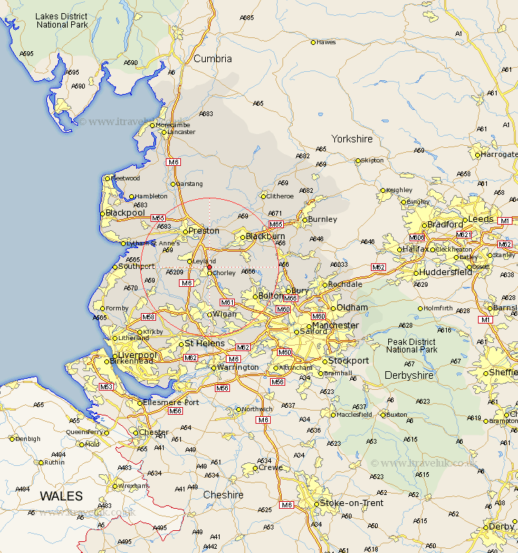
Lancashire Map Showing Location of Heapey
Population: 955
District: Chorley
Easting: 359259 Northing: 419115
Latitude: 53.67 Longitude: -2.62
 = Heapey
District: Chorley
Easting: 359259 Northing: 419115
Latitude: 53.67 Longitude: -2.62
= Heapey
This Heapey map below is supplied by Google. Use the tools in the top left corner to zoom into street level or zoom out for a road map, you may also need to zoom in to see Heapey on the map. Click and drag the map to move around. If the map fails to load try and refresh your browser or zoom in or out (+ or -).
Update - it seems Google no longer allow people to use their maps for free! This Heapey map sometimes loads and sometimes gives a error. I am working on a solution.
Closest 30 Towns or Cities to Heapey (Population over 500)
Chorley 1.86km Brinscall 3.78km Euxton 3.78km Withnell 5.74km Leyland 5.79km Hoghton 5.98km Coppull 5.98km Adlington 7.5km Eccleston 7.57km Haigh 7.74km Farrington 7.81km Farington 7.81km Penrith 7.91km Horwich 8.62km Blackrod 9.53km Standish 9.84km Croston 10.06km Darwen 10.55km Samlesbury 11.12km Mawdesley 11.34km Shevington 11.96km Penwortham 12.03km Bretherton 12.08km Hutton 12.34km Mellor 12.4km Hoole 12.63km Much Hoole 12.63km Blackburn 12.76km Preston 12.92km Appley Bridge 12.93km