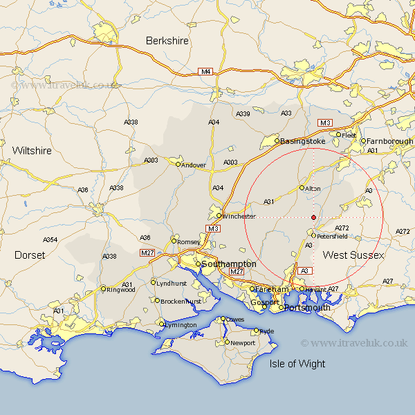
Hampshire Map Showing Location of Hawkley
Population: 463
District: East Hampshire
Easting: 474759 Northing: 128450
Latitude: 51.05 Longitude: -0.93
 = Hawkley
District: East Hampshire
Easting: 474759 Northing: 128450
Latitude: 51.05 Longitude: -0.93
= Hawkley
This Hawkley map below is supplied by Google. Use the tools in the top left corner to zoom into street level or zoom out for a road map, you may also need to zoom in to see Hawkley on the map. Click and drag the map to move around. If the map fails to load try and refresh your browser or zoom in or out (+ or -).
Update - it seems Google no longer allow people to use their maps for free! This Hawkley map sometimes loads and sometimes gives a error. I am working on a solution.
Closest 30 Towns or Cities to Hawkley (Population over 500)
Greatham 2.33km Liss 2.98km Steep 3.7km Selborne 3.7km Petersfield 5.56km Froxfield 5.95km Farringdon 6.57km Faringdon 6.57km Upper Farringdon 6.57km Kingsley 8.76km Buriton 9.33km Bordon Camp 9.43km Bordon 9.43km Liphook 9.5km Alton 9.9km Bramshot 10.03km East Meon 10.19km Ropley 10.65km Headley 11.02km Four Marks 11.02km West Meon 11.12km Binsted 11.66km Medstead 11.91km Bramdean 12.95km Froyle 13.03km Clanfield 13.79km Horndean 15.23km Bentley 15.54km Cheriton 16.31km New Alresford 16.72km