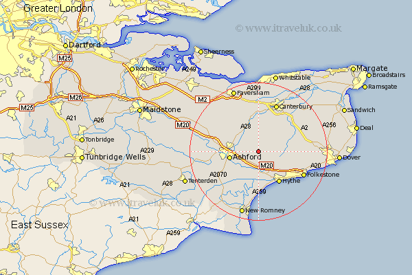
Kent Map Showing Location of Hastingleigh
Population: 247
District: Ashford
Easting: 609788 Northing: 143308
Latitude: 51.15 Longitude: 1
 = Hastingleigh
District: Ashford
Easting: 609788 Northing: 143308
Latitude: 51.15 Longitude: 1
= Hastingleigh
This Hastingleigh map below is supplied by Google. Use the tools in the top left corner to zoom into street level or zoom out for a road map, you may also need to zoom in to see Hastingleigh on the map. Click and drag the map to move around. If the map fails to load try and refresh your browser or zoom in or out (+ or -).
Update - it seems Google no longer allow people to use their maps for free! This Hastingleigh map sometimes loads and sometimes gives a error. I am working on a solution.
Closest 30 Towns or Cities to Hastingleigh (Population over 500)
Brabourne 1.86km Smeeth 4.37km Hinxhill 5.01km Sellinge 5.56km Sellindge 5.56km Stelling 5.94km Wye 5.94km Lyminge 6.89km Mersham 7.25km Kennington 8.14km Elham 8.14km Petham 8.19km Aldington 8.2km Ashford 8.35km Chilham 9.55km Lympne 9.55km Lower Hardres 10.36km Hythe 10.94km Chartham 11.18km Kingsnorth 11.85km Bridge 12.32km Hothfield 12.79km Hawkinge 12.89km Swingfield 12.92km Ruckinge 13.78km Rockinge 13.78km Shadoxhurst 13.95km Orlestone 13.98km Selling 14.22km Folkstone 14.79km