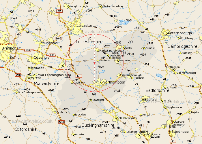
Northamptonshire Map Showing Location of Haselbech
Population: 87
District: Daventry
Easting: 471457 Northing: 276701
Latitude: 52.38 Longitude: -0.95
 = Haselbech
District: Daventry
Easting: 471457 Northing: 276701
Latitude: 52.38 Longitude: -0.95
= Haselbech
This Haselbech map below is supplied by Google. Use the tools in the top left corner to zoom into street level or zoom out for a road map, you may also need to zoom in to see Haselbech on the map. Click and drag the map to move around. If the map fails to load try and refresh your browser or zoom in or out (+ or -).
Update - it seems Google no longer allow people to use their maps for free! This Haselbech map sometimes loads and sometimes gives a error. I am working on a solution.
Closest 30 Towns or Cities to Haselbech (Population over 500)
Naseby 2.26km Clipston 3.71km Guilsborough 6.51km Spratton 7.41km Welford 7.73km Brixworth 8.15km West Haddon 9.68km Pitsford 10.31km East Haddon 10.31km Desborough 10.62km Walgrave 10.62km Rowell 10.83km Rothwell 10.83km Yelvertoft 11.46km Boughton 11.63km Long Buckby 12.19km Broughton 12.58km Moulton 13.03km Crick 13.63km Overstone 14.34km Wilbarston 15.07km Northampton 15.5km Kilsby 15.73km Sywell 15.87km Kettering 15.94km Harpole 16.83km Great Billing 17.37km Billing 17.37km Isham 17.37km Cottingham 17.54km