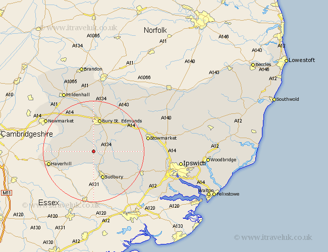
Suffolk Map Showing Location of Hartest
Population: 427
District: Babergh
Easting: 583630 Northing: 251774
Latitude: 52.13 Longitude: 0.68
 = Hartest
District: Babergh
Easting: 583630 Northing: 251774
Latitude: 52.13 Longitude: 0.68
= Hartest
This Hartest map below is supplied by Google. Use the tools in the top left corner to zoom into street level or zoom out for a road map, you may also need to zoom in to see Hartest on the map. Click and drag the map to move around. If the map fails to load try and refresh your browser or zoom in or out (+ or -).
Update - it seems Google no longer allow people to use their maps for free! This Hartest map sometimes loads and sometimes gives a error. I am working on a solution.
Closest 30 Towns or Cities to Hartest (Population over 500)
Glemsford 3.87km Lawshall 3.88km Cavendish 6.52km Cockfield 7.07km Chedburgh 7.19km Long Melford 7.75km Wickhambrook 8.17km Chevington 8.7km Lavenham 8.78km Clare 8.81km Hundon 9.83km Great Waldingfield 10.07km Waldingfield 10.07km Rushbrooke 10.88km Bradfield 10.88km Bradfield St George 10.88km Bradfield St. George 10.88km Bradfield Saint George 10.88km Sudbury 11.63km Great Cornard 12.49km Barrow 13.04km Bury St. Edmunds 13.17km Bury St Edmunds 13.17km Bury Saint Edmunds 13.17km Rattlesden 14.73km Kedington 14.75km Fornham All Saints 14.88km Hitcham 14.91km Risby 15.22km Thurston 15.84km