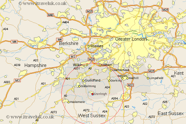
Surrey Map Showing Location of Cranleigh
Population: 9417
Area Size (ha): 310
District: Waverley
Easting: 506105 Northing: 138265
Latitude: 51.13 Longitude: -0.48
 = Cranleigh
Area Size (ha): 310
District: Waverley
Easting: 506105 Northing: 138265
Latitude: 51.13 Longitude: -0.48
= Cranleigh
This Cranleigh map below is supplied by Google. Use the tools in the top left corner to zoom into street level or zoom out for a road map, you may also need to zoom in to see Cranleigh on the map. Click and drag the map to move around. If the map fails to load try and refresh your browser or zoom in or out (+ or -).
Update - it seems Google no longer allow people to use their maps for free! This Cranleigh map sometimes loads and sometimes gives a error. I am working on a solution.
Closest 30 Towns or Cities to Cranleigh (Population over 500)
Ewhurst 3.49km Alfold 6.03km Wonersh 6.56km Dunsfold 6.89km Bramley 7.25km Albury 7.42km Shere 7.51km Abinger 8.04km Ockley 9.3km Shalford 9.42km Hambledon 9.49km Saint Martha 9.56km St. Martha 9.56km St Martha 9.56km Chilworth 9.56km Goldaming 9.85km Godalming 9.85km Chiddingfold 10.02km Wotton 10.18km Witley 10.47km Guildford 10.94km Guilford 10.94km Milford 11.1km Capel 11.63km Compton 12.82km Holmwood 12.88km West Clandon 13.03km Westcott 13.13km Horsley 13.44km East Horsley 13.44km