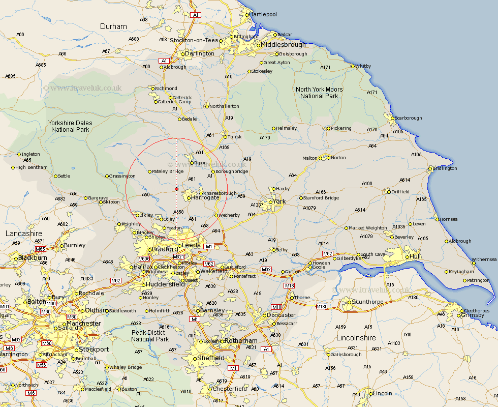
Yorkshire Map Showing Location of Hampsthwaite
Population: 944
District: Harrogate
Easting: 426206 Northing: 457949
Latitude: 54.02 Longitude: -1.6
 = Hampsthwaite
District: Harrogate
Easting: 426206 Northing: 457949
Latitude: 54.02 Longitude: -1.6
= Hampsthwaite
This Hampsthwaite map below is supplied by Google. Use the tools in the top left corner to zoom into street level or zoom out for a road map, you may also need to zoom in to see Hampsthwaite on the map. Click and drag the map to move around. If the map fails to load try and refresh your browser or zoom in or out (+ or -).
Update - it seems Google no longer allow people to use their maps for free! This Hampsthwaite map sometimes loads and sometimes gives a error. I am working on a solution.
Closest 30 Towns or Cities to Hampsthwaite (Population over 500)
Birstwith 2.15km Killinghall 3.27km Harrogate 5.73km Darley 6.79km Dacre 8.47km Burton Leonard 8.58km Pannal 8.6km Knaresborough 8.91km Monkton 9.87km Bishop Monkton 9.87km Weeton 11.33km Ripon 12.38km Arthington 12.98km Arthington Junction Station 12.98km Poole 13.02km Pool 13.02km Pool-in-Wharfedale 13.02km Bewerley 13.16km Otley 14.07km Harewood 14.53km Burley in Wharfedale 14.83km Burley 14.83km Bramhope 14.87km Boroughbridge 15.01km Marton le Moor 16.22km Marton 16.22km Kirkby Malzeard 17km Menston 17.21km Yeadon 17.24km Ilkley 18.01km