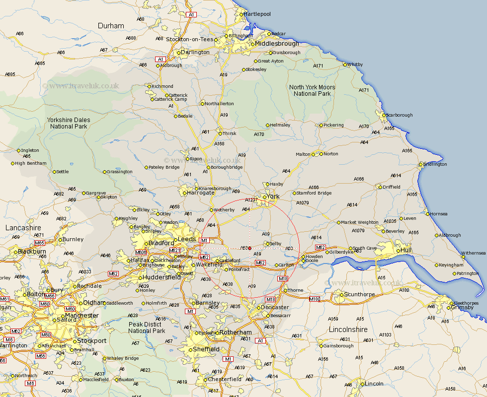
Yorkshire Map Showing Location of Hambleton
Population: 1556
Area Size (ha): 46
District: Selby
Easting: 454923 Northing: 430385
Latitude: 53.77 Longitude: -1.17
 = Hambleton
Area Size (ha): 46
District: Selby
Easting: 454923 Northing: 430385
Latitude: 53.77 Longitude: -1.17
= Hambleton
This Hambleton map below is supplied by Google. Use the tools in the top left corner to zoom into street level or zoom out for a road map, you may also need to zoom in to see Hambleton on the map. Click and drag the map to move around. If the map fails to load try and refresh your browser or zoom in or out (+ or -).
Update - it seems Google no longer allow people to use their maps for free! This Hambleton map sometimes loads and sometimes gives a error. I am working on a solution.
Closest 30 Towns or Cities to Hambleton (Population over 500)
Monk Fryston 4.76km South Milford 5.48km Brayton 5.48km Church Fenton 6.46km Sherburn in Elmet 6.61km Sherburn 6.61km Selby 6.83km Wistow 7.08km Cawood 8.1km Brotherton 8.61km Knottingly 8.62km Knottingley 8.62km Hensall 8.62km Whitley 9.34km Ulleskelf 9.83km Barlow 10.03km Riccall 10.66km Micklefield 11.56km Hemingbrough 12.05km Cliffe Common 12.05km Cliff Common Station 12.05km Aberford 12.28km Carlton 12.34km Darrington 12.4km Pontefract 12.76km Snaith 12.77km Pollington 12.92km Kippax 13.15km Castleford 13.28km Garforth 14.36km