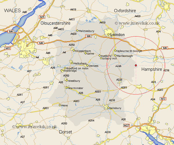
Wiltshire Map Showing Location of Ham
Population: 152
District: Kennet
Easting: 433655 Northing: 161380
Latitude: 51.35 Longitude: -1.52
 = Ham
= Ham
District: Kennet
Easting: 433655 Northing: 161380
Latitude: 51.35 Longitude: -1.52
= Ham
This Ham map below is supplied by Google. Use the tools in the top left corner to zoom into street level or zoom out for a road map, you may also need to zoom in to see Ham on the map. Click and drag the map to move around. If the map fails to load try and refresh your browser or zoom in or out (+ or -).
Update - it seems Google no longer allow people to use their maps for free! This Ham map sometimes loads and sometimes gives a error. I am working on a solution.
Closest 30 Towns or Cities to Ham (Population over 500)
Shalbourn 2.31km Shalbourne 2.31km Great Bedwyn 6.08km Bedwyn 6.08km Grafton 8.31km Burbage 10.58km Ramsbury 10.92km Collingbourne Ducis 11.87km Aldbourne 14.71km Marlborough 15.74km Baydon 15.91km Pewsey 16.31km North Tidworth 16.65km Tidworth 16.65km Lugershall 19.08km Ludgershall 19.08km Chiseldon 21.69km Bishopstone 21.93km Upavon 22.13km Enford 22.62km Netheravon 22.63km Figheldean 23.74km Wanborough 24.02km Bulford 24.1km Durrington 25.42km Wroughton 26.18km Broad Hinton 26.49km Amesbury 27.56km Idmiston 27.83km Lark Hill 27.91km