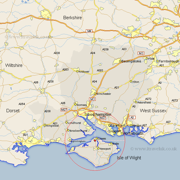
Hampshire Map Showing Location of Gurnard
Population: 1696
Easting: 448201 Northing: 94774
Latitude: 50.75 Longitude: -1.32
 = Gurnard
Easting: 448201 Northing: 94774
Latitude: 50.75 Longitude: -1.32
= Gurnard
This Gurnard map below is supplied by Google. Use the tools in the top left corner to zoom into street level or zoom out for a road map, you may also need to zoom in to see Gurnard on the map. Click and drag the map to move around. If the map fails to load try and refresh your browser or zoom in or out (+ or -).
Update - it seems Google no longer allow people to use their maps for free! This Gurnard map sometimes loads and sometimes gives a error. I am working on a solution.
Closest 30 Towns or Cities to Gurnard (Population over 500)
East Cowes 1.17km Northwood 1.86km Cowes 2.2km Newport 6.03km Wootton 6.94km Fawley 7.78km Shalfleet 8.08km Lee-on-the-Solent 9.91km Lee on the Solent 9.91km Lee on Solent 9.91km Lee-on-Solent 9.91km Arreton 10.38km Ryde 10.72km Calbourne 10.96km Hamble 11.12km Hample 11.12km Rookley 11.36km Bewley 11.95km Beaulieu 11.95km Locks Heath 12.25km Newchurch 12.38km Netley 13.03km Netley Marsh 13.03km Bursledon 13.03km Shorwell 13.19km Ashurst 13.28km Brightstone 13.8km Brighstone 13.8km Brading 13.88km Gosport 14.04km