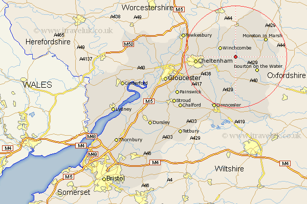
Gloucestershire Map Showing Location of Guiting Power
Population: 313
District: Cotswold
Easting: 409169 Northing: 224298
Latitude: 51.92 Longitude: -1.87
 = Guiting Power
District: Cotswold
Easting: 409169 Northing: 224298
Latitude: 51.92 Longitude: -1.87
= Guiting Power
This Guiting Power map below is supplied by Google. Use the tools in the top left corner to zoom into street level or zoom out for a road map, you may also need to zoom in to see Guiting Power on the map. Click and drag the map to move around. If the map fails to load try and refresh your browser or zoom in or out (+ or -).
Update - it seems Google no longer allow people to use their maps for free! This Guiting Power map sometimes loads and sometimes gives a error. I am working on a solution.
Closest 30 Towns or Cities to Guiting Power (Population over 500)
Winchcomb 6.81km Winchcombe 6.81km Andoversford 7.98km Stow on the Wold 9.33km Stow-on-the-Wold 9.33km Bourton-on-the-Water 9.75km Bourton on the Water 9.75km Northleach 9.89km Withington 10.9km Alderton 11.76km Southam 12.71km Dumbleton 13.06km Chedworth 13.42km Moreton-in-Marsh 13.61km Moreton in the Marsh 13.61km Moreton in Marsh 13.61km Blockley 13.69km Chipping Campden 14.17km Bishops Cleeve 14.2km Charlton Kings 14.81km Cheltenham 14.98km Leckhampton 15.87km Swindon 16.11km Bledington 16.44km Ebrington 17.41km Shurdington 18.03km North Cerney 18.04km Bibury 18.85km Ashchurch 19.47km Mickleton 19.75km