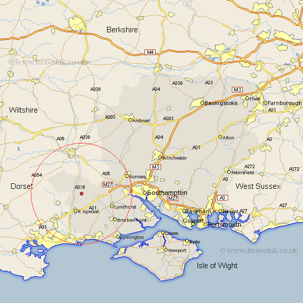
Hampshire Map Showing Location of Godshill
Population: 458
District: New Forest
Easting: 417572 Northing: 113117
Latitude: 50.92 Longitude: -1.75
 = Godshill
District: New Forest
Easting: 417572 Northing: 113117
Latitude: 50.92 Longitude: -1.75
= Godshill
This Godshill map below is supplied by Google. Use the tools in the top left corner to zoom into street level or zoom out for a road map, you may also need to zoom in to see Godshill on the map. Click and drag the map to move around. If the map fails to load try and refresh your browser or zoom in or out (+ or -).
Update - it seems Google no longer allow people to use their maps for free! This Godshill map sometimes loads and sometimes gives a error. I am working on a solution.
Closest 30 Towns or Cities to Godshill (Population over 500)
Hale 3.88km Fordingbridge 3.96km Ibsley 4.39km Sandleheath 5.97km South Damerham 7.25km Damerham 7.25km Ringwood 7.78km Bramshaw 9.53km Minstead 11.16km Burley 11.66km Cadnam 11.68km West Wellow 12.93km Lyndhurst 12.94km Sherfield English 13.83km Bransgore 14.88km Sopley 16.84km Brockenhurst 17.01km Sway 18.19km Totton 18.69km Eling 18.79km Romsey 19.01km Hordle 21.32km New Milton 21.57km Milton 21.57km Michelmersh 21.78km Michlemersh 21.78km Marchwood 22.51km Boldre 22.58km Dibden 22.9km Barton-on-Sea 23km