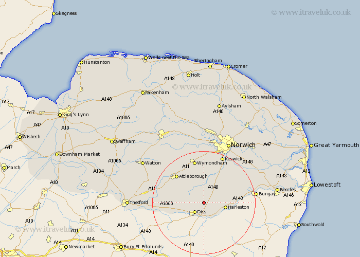
Norfolk Map Showing Location of Gissing
Population: 254
District: South Norfolk
Easting: 615320 Northing: 284615
Latitude: 52.42 Longitude: 1.17
 = Gissing
District: South Norfolk
Easting: 615320 Northing: 284615
Latitude: 52.42 Longitude: 1.17
= Gissing
This Gissing map below is supplied by Google. Use the tools in the top left corner to zoom into street level or zoom out for a road map, you may also need to zoom in to see Gissing on the map. Click and drag the map to move around. If the map fails to load try and refresh your browser or zoom in or out (+ or -).
Update - it seems Google no longer allow people to use their maps for free! This Gissing map sometimes loads and sometimes gives a error. I am working on a solution.
Closest 30 Towns or Cities to Gissing (Population over 500)
Burston 2.17km Diss 5.03km Scole 5.56km Pulham 5.65km Moulton St Michael 5.67km Great Moulton 5.67km Moulton Saint Michael 5.67km Moulton St. Michael 5.67km Moulton 5.67km Roydon 7.17km Bunwell 7.74km Harleston 8.13km Long Stratton 8.67km Brockdish 8.77km Forncett Saint Mary 9.53km Forncett 9.53km Forncett St. Mary 9.53km Forncett St Mary 9.53km Banham 9.77km Bressingham 9.78km Old Buckenham 10.83km North Lopham 11.46km Kenninghall 12.57km Hempnall 12.94km Quidenham 12.97km Ashwellthorpe 13.01km Besthorpe 14.33km Saxlingham Thorpe 14.63km Saxlingham 14.63km Attleborough 15.06km