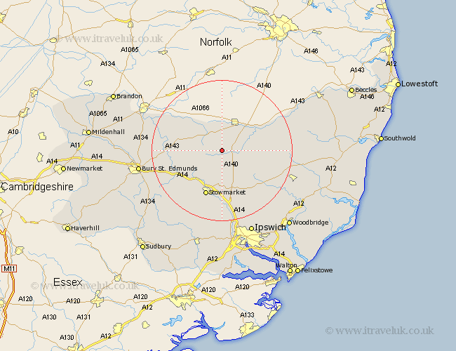
Suffolk Map Showing Location of Gislingham
Population: 878
District: Mid Suffolk
Easting: 607936 Northing: 271299
Latitude: 52.3 Longitude: 1.05
 = Gislingham
District: Mid Suffolk
Easting: 607936 Northing: 271299
Latitude: 52.3 Longitude: 1.05
= Gislingham
This Gislingham map below is supplied by Google. Use the tools in the top left corner to zoom into street level or zoom out for a road map, you may also need to zoom in to see Gislingham on the map. Click and drag the map to move around. If the map fails to load try and refresh your browser or zoom in or out (+ or -).
Update - it seems Google no longer allow people to use their maps for free! This Gislingham map sometimes loads and sometimes gives a error. I am working on a solution.
Closest 30 Towns or Cities to Gislingham (Population over 500)
Botesdale 4.34km Bacton 4.34km Wortham 5.56km Mendlesham 5.67km Thorndon 5.96km Eye 7.05km Redgrave 8.16km Badwell Ash 9.26km Old Newton 9.54km Hepworth 9.79km Haughley 10.31km Stanton 10.36km Hopton 10.86km Hoxne 11.61km Barningham 11.61km Elmswell 11.72km Debenham 12.97km Norton 13.66km Bardwell 13.72km Stowmarket 13.75km Woolpit 13.78km Worlingworth 14.1km Ixworth 14.73km Stradbroke 14.85km Pakenham 15.2km Finborough 16.82km Great Finborough 16.82km Thurston 16.82km Rattlesden 17.24km Honington 17.39km