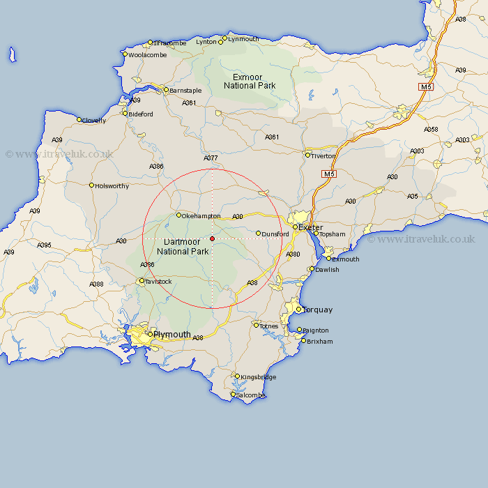
Devon Map Showing Location of Gidleigh
Population: 116
District: West Devon
Easting: 268097 Northing: 86952
Latitude: 50.67 Longitude: -3.87
 = Gidleigh
District: West Devon
Easting: 268097 Northing: 86952
Latitude: 50.67 Longitude: -3.87
= Gidleigh
This Gidleigh map below is supplied by Google. Use the tools in the top left corner to zoom into street level or zoom out for a road map, you may also need to zoom in to see Gidleigh on the map. Click and drag the map to move around. If the map fails to load try and refresh your browser or zoom in or out (+ or -).
Update - it seems Google no longer allow people to use their maps for free! This Gidleigh map sometimes loads and sometimes gives a error. I am working on a solution.
Closest 30 Towns or Cities to Gidleigh (Population over 500)
Chagford 2.99km Drewsteignton 6.94km South Tawton 7.77km Moretonhampstead 8.43km Dartmoor Forest 9.92km Lustleigh 11.95km Cheriton Bishop 11.96km Okehampton 11.96km Widdecombe 12.07km Widecombe in the Moor 12.07km Dunsford 13.05km Sampford Courtenay 14.23km Sampford Courtnay 14.23km Sampford Courtney 14.23km Ilsington 14.57km Tedburn St. Mary 14.89km Tedburn Saint Mary 14.89km Tedburn St Mary 14.89km North Tawton 15.01km Nymet Tracey 15.23km Bow 15.23km Christow 15.39km Bovey Tracey 15.91km Hennock 15.94km Bridestowe 16.55km Copplestone 16.94km Holcombe Burnell 17.35km Ashburton 18.6km Crediton 20.02km Whitestone 20.19km