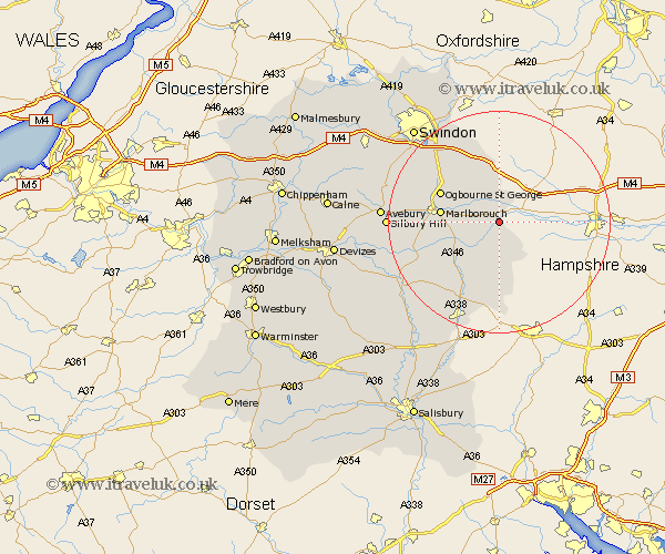
Wiltshire Map Showing Location of Froxfield
Population: 369
District: Kennet
Easting: 430141 Northing: 166918
Latitude: 51.4 Longitude: -1.57
 = Froxfield
District: Kennet
Easting: 430141 Northing: 166918
Latitude: 51.4 Longitude: -1.57
= Froxfield
This Froxfield map below is supplied by Google. Use the tools in the top left corner to zoom into street level or zoom out for a road map, you may also need to zoom in to see Froxfield on the map. Click and drag the map to move around. If the map fails to load try and refresh your browser or zoom in or out (+ or -).
Update - it seems Google no longer allow people to use their maps for free! This Froxfield map sometimes loads and sometimes gives a error. I am working on a solution.
Closest 30 Towns or Cities to Froxfield (Population over 500)
Ramsbury 4.37km Great Bedwyn 4.37km Bedwyn 4.37km Shalbourn 5.68km Shalbourne 5.68km Aldbourne 8.19km Grafton 8.74km Baydon 9.55km Burbage 10.16km Marlborough 10.57km Collingbourne Ducis 14.21km Pewsey 14.73km Chiseldon 15.22km Bishopstone 15.53km Wanborough 17.46km Tidworth 19.8km North Tidworth 19.8km Wroughton 19.84km Broad Hinton 20.67km Upavon 21.68km Broad Town 22.76km Ludgershall 22.98km Lugershall 22.98km Swindon 22.99km Enford 23.26km Netheravon 23.88km Stratton Saint Margaret 24.01km Stratton 24.01km Stratton St. Margaret 24.01km Stratton St Margaret 24.01km