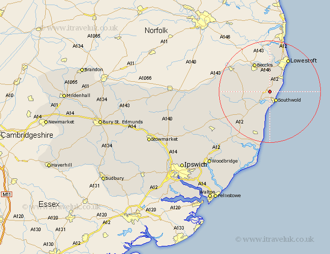
Suffolk Map Showing Location of Frostenden
Population: 197
District: Waveney
Easting: 648455 Northing: 280607
Latitude: 52.37 Longitude: 1.65
 = Frostenden
District: Waveney
Easting: 648455 Northing: 280607
Latitude: 52.37 Longitude: 1.65
= Frostenden
This Frostenden map below is supplied by Google. Use the tools in the top left corner to zoom into street level or zoom out for a road map, you may also need to zoom in to see Frostenden on the map. Click and drag the map to move around. If the map fails to load try and refresh your browser or zoom in or out (+ or -).
Update - it seems Google no longer allow people to use their maps for free! This Frostenden map sometimes loads and sometimes gives a error. I am working on a solution.
Closest 30 Towns or Cities to Frostenden (Population over 500)
Reydon 2.17km Wrentham 2.92km Wangford 2.93km Southwold 4.35km Kessingland 7.17km Gisleham 8.68km Wenhaston 8.78km Holton 9.79km Carlton Colville 9.86km Worlingham 10.31km Halesworth 10.35km Beccles 12.47km Oulton 14.14km Yoxford 14.34km Lowestoft 14.63km Cookley 14.68km Bungay 16.43km Corton 18.46km Leiston 19.38km Saxmundham 19.55km Laxfield 20.63km Thorpeness 22.35km Thorpe 22.35km Snape 22.8km Fressingfield 23.84km Aldeburgh 24.33km Dennington 26.26km Stradbroke 26.63km Framlingham 27.24km Tunstall 29.31km