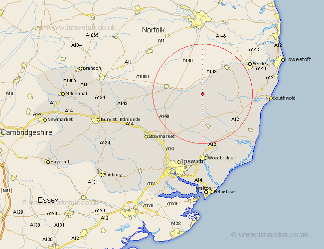
Suffolk Map Showing Location of Fressingfield
Population: 983
District: Mid Suffolk
Easting: 624722 Northing: 277605
Latitude: 52.35 Longitude: 1.3
 = Fressingfield
District: Mid Suffolk
Easting: 624722 Northing: 277605
Latitude: 52.35 Longitude: 1.3
= Fressingfield
This Fressingfield map below is supplied by Google. Use the tools in the top left corner to zoom into street level or zoom out for a road map, you may also need to zoom in to see Fressingfield on the map. Click and drag the map to move around. If the map fails to load try and refresh your browser or zoom in or out (+ or -).
Update - it seems Google no longer allow people to use their maps for free! This Fressingfield map sometimes loads and sometimes gives a error. I am working on a solution.
Closest 30 Towns or Cities to Fressingfield (Population over 500)
Stradbroke 4.34km Hoxne 6.79km Laxfield 7.17km Dennington 9.26km Worlingworth 9.87km Cookley 10.84km Eye 10.84km Thorndon 13.54km Halesworth 13.58km Holton 14.84km Framlingham 14.99km Bungay 15.07km Debenham 16.81km Wortham 16.98km Wenhaston 17.39km Yoxford 17.4km Gislingham 17.88km Botesdale 19.34km Mendlesham 19.37km Saxmundham 20.12km Redgrave 20.46km Bacton 21.37km Wangford 21.51km Worlingham 22.21km Beccles 22.26km Otley 22.7km Wickham Market 22.7km Snape 23km Old Newton 24.31km Leiston 24.64km