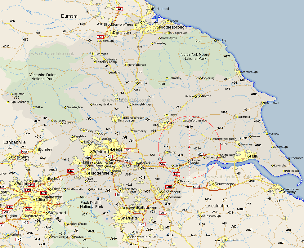
Yorkshire Map Showing Location of Foggathorpe
Population: 233
Easting: 474606 Northing: 436221
Latitude: 53.82 Longitude: -0.87
 = Foggathorpe
Easting: 474606 Northing: 436221
Latitude: 53.82 Longitude: -0.87
= Foggathorpe
This Foggathorpe map below is supplied by Google. Use the tools in the top left corner to zoom into street level or zoom out for a road map, you may also need to zoom in to see Foggathorpe on the map. Click and drag the map to move around. If the map fails to load try and refresh your browser or zoom in or out (+ or -).
Update - it seems Google no longer allow people to use their maps for free! This Foggathorpe map sometimes loads and sometimes gives a error. I am working on a solution.
Closest 30 Towns or Cities to Foggathorpe (Population over 500)
Bubwith 3.28km Seaton Ross 4.95km Holme 6.82km Holme upon Spalding Moor 6.82km Melbourne 7.49km Eastrington 9.22km Howden 9.27km Cliffe Common 9.47km Hemingbrough 9.47km Cliff Common Station 9.47km Wheldrake 9.89km Goole 11.12km Hook 11.17km Airmyn 11.33km Sutton 11.59km Sutton upon Derwent 11.59km Riccall 12.17km Barlow 12.33km Barmby 13.37km Barmby on the Moor 13.37km Barmby-on-the-Moor 13.37km Selby 13.65km Escrick 14.12km Market Weighton 14.25km Wilberfoss 14.86km Swinefleet 14.99km Pocklington 15.05km Brayton 15.28km North Cave 15.28km Wistow 15.32km