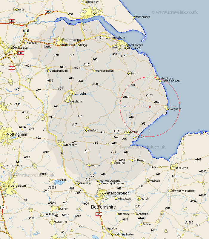
Lincolnshire Map Showing Location of Firsby
Population: 276
District: East Lindsey
Easting: 545992 Northing: 363687
Latitude: 53.15 Longitude: 0.18
 = Firsby
District: East Lindsey
Easting: 545992 Northing: 363687
Latitude: 53.15 Longitude: 0.18
= Firsby
This Firsby map below is supplied by Google. Use the tools in the top left corner to zoom into street level or zoom out for a road map, you may also need to zoom in to see Firsby on the map. Click and drag the map to move around. If the map fails to load try and refresh your browser or zoom in or out (+ or -).
Update - it seems Google no longer allow people to use their maps for free! This Firsby map sometimes loads and sometimes gives a error. I am working on a solution.
Closest 30 Towns or Cities to Firsby (Population over 500)
Burgh le Marsh 4.45km Croft 4.82km Spilsby 6.68km Wainfleet 7.12km Wainfleet All Saints 7.12km Willoughby 7.5km Friskney 9.26km Ingoldmells 10.66km Alford 11.12km Skegness 11.27km Chapel St. Leonards 11.57km Chapel St Leonards 11.57km Chapel Saint Leonards 11.57km Huttoft 12.43km Stickney 13.37km Wrangle 13.72km Old Leake 15.83km Leake 15.83km Mareham-on-the-Hill 17.07km Mareham 17.07km Mareham on the Hill 17.07km Sibsey 17.1km Carrington 17.25km Leverton 17.97km Frithville 19.44km Sutton on Sea 19.69km Sutton-on-Sea 19.69km Bennington 19.7km Benington 19.7km Butterwick 20.11km