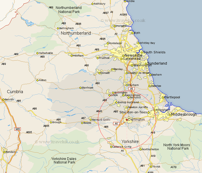
Durham Map Showing Location of Darlington
Population: 85404
Area Size (ha): 203
Easting: 428037 Northing: 515436
Latitude: 54.53 Longitude: -1.57
 = Darlington
Area Size (ha): 203
Easting: 428037 Northing: 515436
Latitude: 54.53 Longitude: -1.57
= Darlington
This Darlington map below is supplied by Google. Use the tools in the top left corner to zoom into street level or zoom out for a road map, you may also need to zoom in to see Darlington on the map. Click and drag the map to move around. If the map fails to load try and refresh your browser or zoom in or out (+ or -).
Update - it seems Google no longer allow people to use their maps for free! This Darlington map sometimes loads and sometimes gives a error. I am working on a solution.
Closest 30 Towns or Cities to Darlington (Population over 500)
Hurworth 6.43km Newton Aycliffe 9.27km Gainford 10.91km Stillington 11.35km Carlton 12.1km Shildon 12.35km Eaglescliffe 13.98km Egglescliffe 14.1km Yarm on Tees 14.47km Yarm-on-Tees 14.47km Yarm 14.47km Bishop Auckland 14.49km Stockton on Tees 14.64km Stockton-on-Tees 14.64km Stockton 14.64km Grindon 15.02km West Auckland 15.46km Staindrop 15.5km Sedgefield 15.56km Coundon 15.77km Evenwood 15.88km Ferryhill 16.72km Thornaby 17.21km Thornaby on Tees 17.21km Thornaby-on-Tees 17.21km Bishop Middleham 17.52km High Etherley 17.55km Etherley 17.55km Cockfield 17.67km Spennymoor 18.58km