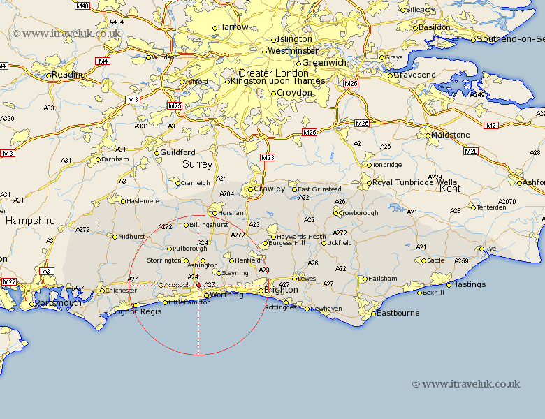
Sussex Map Showing Location of Findon
Population: 1735
Area Size (ha): 69
District: Arun
Easting: 512619 Northing: 106890
Latitude: 50.85 Longitude: -0.4
 = Findon
Area Size (ha): 69
District: Arun
Easting: 512619 Northing: 106890
Latitude: 50.85 Longitude: -0.4
= Findon
This Findon map below is supplied by Google. Use the tools in the top left corner to zoom into street level or zoom out for a road map, you may also need to zoom in to see Findon on the map. Click and drag the map to move around. If the map fails to load try and refresh your browser or zoom in or out (+ or -).
Update - it seems Google no longer allow people to use their maps for free! This Findon map sometimes loads and sometimes gives a error. I am working on a solution.
Closest 30 Towns or Cities to Findon (Population over 500)
Worthing 4.08km Sompting 5.1km Washington 5.56km Lancing 5.97km North Lancing 5.97km West Ferring 6.58km Ferring 6.58km Upper Bleeding 6.92km Bramber 6.92km Upper Beeding 6.92km Steyning 6.92km Angmering 6.93km Ashington 7.51km Kingston 8.21km Storrington 8.34km East Preston 8.77km Preston 8.77km Rustington 8.96km Thakeham 9.34km West Chillington 9.9km West Chiltington 9.9km Arundel 10.53km Littlehampton 10.89km Shoreham 11.85km Shoreham-by-Sea 11.85km New Shoreham 11.85km Shoreham by Sea 11.85km Henfield 11.93km Amberley 11.94km Bury 12.95km