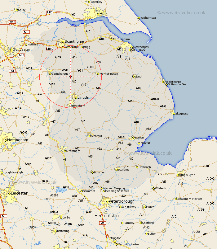
Lincolnshire Map Showing Location of Fillingham
Population: 170
District: West Lindsey
Easting: 494253 Northing: 386501
Latitude: 53.37 Longitude: -0.58
 = Fillingham
District: West Lindsey
Easting: 494253 Northing: 386501
Latitude: 53.37 Longitude: -0.58
= Fillingham
This Fillingham map below is supplied by Google. Use the tools in the top left corner to zoom into street level or zoom out for a road map, you may also need to zoom in to see Fillingham on the map. Click and drag the map to move around. If the map fails to load try and refresh your browser or zoom in or out (+ or -).
Update - it seems Google no longer allow people to use their maps for free! This Fillingham map sometimes loads and sometimes gives a error. I am working on a solution.
Closest 30 Towns or Cities to Fillingham (Population over 500)
Ingham 3.71km Willingham 6.89km Scampton 7.5km Scrampton 7.5km Welton 9.96km Waddingham 10.26km Dunholm 10.72km Dunholme 10.72km Lea 11.06km Kirton 11.17km Kirton in Lindsey 11.17km Marton 11.4km Blyton 11.53km Scotton 11.97km Saxilby 11.97km Gainesborough 12.3km Gainsborough 12.3km Scothern 12.82km Nettleham 12.95km Torksey 13.61km Morton 13.77km Scotter 14.09km Sudbrooke 14.22km Middle Rasen 14.49km South Kelsey 14.92km Skellingthorpe 15km Hibaldstow 15.19km Lincoln 15.2km Market Rasen 16.69km North Kelsey 17.03km