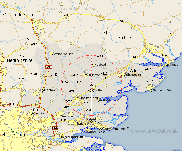
Essex Map Showing Location of Faulkbourne
Population: 101
District: Braintree
Easting: 580336 Northing: 216406
Latitude: 51.82 Longitude: 0.62
 = Faulkbourne
District: Braintree
Easting: 580336 Northing: 216406
Latitude: 51.82 Longitude: 0.62
= Faulkbourne
This Faulkbourne map below is supplied by Google. Use the tools in the top left corner to zoom into street level or zoom out for a road map, you may also need to zoom in to see Faulkbourne on the map. Click and drag the map to move around. If the map fails to load try and refresh your browser or zoom in or out (+ or -).
Update - it seems Google no longer allow people to use their maps for free! This Faulkbourne map sometimes loads and sometimes gives a error. I am working on a solution.
Closest 30 Towns or Cities to Faulkbourne (Population over 500)
Cressing 3.88km Witham 3.89km Hatfield Peverel 3.89km Rivenhall 3.9km Terling 4.95km Wickham Bishops 5.06km Bradwell 5.56km Black Notley 5.89km Rayne 6.01km Kelvedon 6.02km Great Totham 6.02km Totham 6.02km Great Leighs 6.87km Coggeshall 7.2km Boreham 7.21km Stisted 7.41km Feering 7.81km Braintree 8.16km Tiptree 8.23km Little Waltham 9.35km Little Baddow 9.89km Panfield 10.1km Heybridge 10.35km Broomfield 11.72km Malden 12.03km Maldon 12.03km Tolleshunt Knights 12.05km Great Waltham 12.05km Tolleshunt Major 12.71km Marks Tey 12.73km