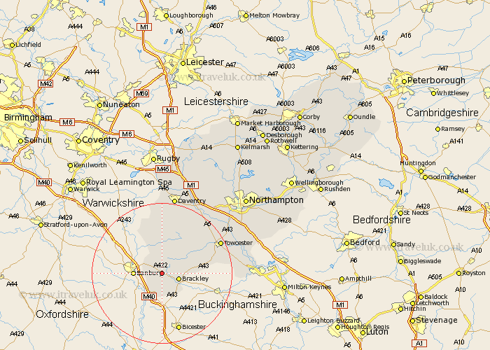
Northamptonshire Map Showing Location of Farthinghoe
Population: 418
District: South Northamptonshire
Easting: 453710 Northing: 239403
Latitude: 52.05 Longitude: -1.22
 = Farthinghoe
District: South Northamptonshire
Easting: 453710 Northing: 239403
Latitude: 52.05 Longitude: -1.22
= Farthinghoe
This Farthinghoe map below is supplied by Google. Use the tools in the top left corner to zoom into street level or zoom out for a road map, you may also need to zoom in to see Farthinghoe on the map. Click and drag the map to move around. If the map fails to load try and refresh your browser or zoom in or out (+ or -).
Update - it seems Google no longer allow people to use their maps for free! This Farthinghoe map sometimes loads and sometimes gives a error. I am working on a solution.
Closest 30 Towns or Cities to Farthinghoe (Population over 500)
Greatworth 2.94km Brackley 4.92km Kings Sutton 5.04km Chacombe 5.87km Chalcombe 5.87km Helmdon 6.79km Croughton 7.5km Aynho 7.76km Chipping Warden 8.17km Syresham 9.3km Byfield 13.03km Boddington 13.75km Upper Boddington 13.75km Silverstone 14.16km Whittlebury 16.37km Towcester 18.44km Badby 18.68km Pattishall 18.84km Paulerspury 19.72km Weedon 21.18km Weedon Beck 21.18km Gayton 21.45km Bugbrooke 21.56km Daventry 22.5km Potterspury 22.87km Blisworth 23.3km Flore 23.34km Denshanger 25.07km Deanshanger 25.07km Kislingbury 25.2km