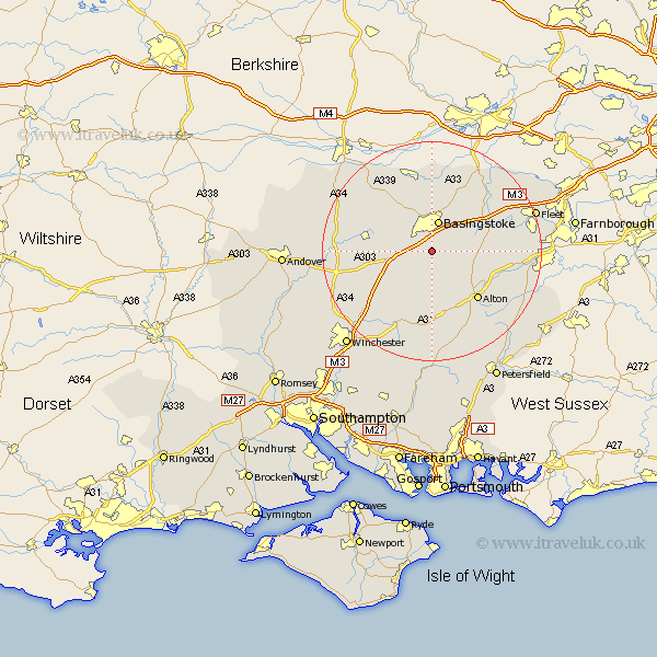
Hampshire Map Showing Location of Farleigh Wallop
Population: 86
District: Basingstoke and Deane
Easting: 462851 Northing: 146831
Latitude: 51.22 Longitude: -1.1
 = Farleigh Wallop
District: Basingstoke and Deane
Easting: 462851 Northing: 146831
Latitude: 51.22 Longitude: -1.1
= Farleigh Wallop
This Farleigh Wallop map below is supplied by Google. Use the tools in the top left corner to zoom into street level or zoom out for a road map, you may also need to zoom in to see Farleigh Wallop on the map. Click and drag the map to move around. If the map fails to load try and refresh your browser or zoom in or out (+ or -).
Update - it seems Google no longer allow people to use their maps for free! This Farleigh Wallop map sometimes loads and sometimes gives a error. I am working on a solution.
Closest 30 Towns or Cities to Farleigh Wallop (Population over 500)
Dummer 3.95km Basingstoke 5.68km North Waltham 6.1km Oakley 6.88km Upton Grey 6.96km Basing 7.24km Overton 10.61km Sherfield 10.93km Sherfield upon Loddon 10.93km Bramley 11.36km Medstead 11.36km Long Sutton 11.61km Four Marks 11.65km Hook 11.83km Rotherwick 11.87km Odiham 12.18km Alton 12.33km Baughurst 13.77km Froyle 13.93km Micheldever 14.87km Silchester 15km Tadley 15km Kingsclere 15.25km Faringdon 15.32km Upper Farringdon 15.32km Farringdon 15.32km New Alresford 15.55km Winchfield 16.07km Whitchurch 16.25km Bentley 16.68km