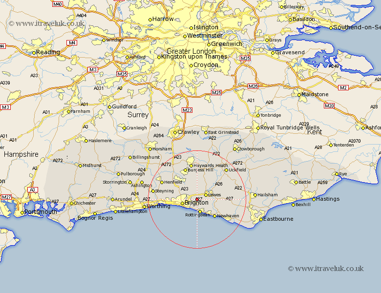
Sussex Map Showing Location of Falmer
Population: 180
District: Lewes
Easting: 536079 Northing: 107451
Latitude: 50.85 Longitude: -0.07
 = Falmer
District: Lewes
Easting: 536079 Northing: 107451
Latitude: 50.85 Longitude: -0.07
= Falmer
This Falmer map below is supplied by Google. Use the tools in the top left corner to zoom into street level or zoom out for a road map, you may also need to zoom in to see Falmer on the map. Click and drag the map to move around. If the map fails to load try and refresh your browser or zoom in or out (+ or -).
Update - it seems Google no longer allow people to use their maps for free! This Falmer map sometimes loads and sometimes gives a error. I am working on a solution.
Closest 30 Towns or Cities to Falmer (Population over 500)
Kingston near Lewes 3.51km Kingston 3.51km Plumpton 3.88km Lewes 3.97km Saltdean 5.53km Rottingdean 5.68km Brighton 6.14km Ditchelling 7.78km Ditchling 7.78km Hove 8.4km Keymer 8.77km Hassocks 8.77km Barcombe Mills Station 8.95km Ringmer 10.06km Hurstpierpoint 10.21km Newhaven 10.22km Southwick 10.69km Portslade 10.69km Wivelsfield 11.18km Shoreham 11.85km Shoreham-by-Sea 11.85km Shoreham by Sea 11.85km New Shoreham 11.85km Albourne 12.36km Chailey 12.56km Isfield 13.16km Burgess Hill 13.79km Newick 14.23km Laughton 14.52km Seaford 14.93km