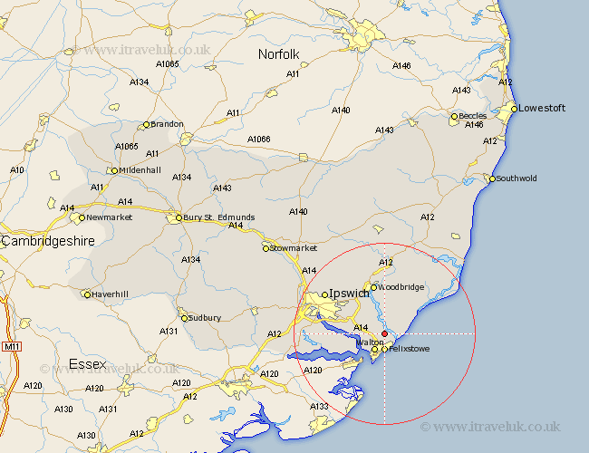
Suffolk Map Showing Location of Falkenham
Population: 180
District: Suffolk Coastal
Easting: 629925 Northing: 238853
Latitude: 52 Longitude: 1.35
 = Falkenham
District: Suffolk Coastal
Easting: 629925 Northing: 238853
Latitude: 52 Longitude: 1.35
= Falkenham
This Falkenham map below is supplied by Google. Use the tools in the top left corner to zoom into street level or zoom out for a road map, you may also need to zoom in to see Falkenham on the map. Click and drag the map to move around. If the map fails to load try and refresh your browser or zoom in or out (+ or -).
Update - it seems Google no longer allow people to use their maps for free! This Falkenham map sometimes loads and sometimes gives a error. I am working on a solution.
Closest 30 Towns or Cities to Falkenham (Population over 500)
Kirton 2.28km Kirkton 2.28km Felixstowe 3.7km Walton 4.23km Sutton 7.42km Bucklesham 7.78km Shotley 7.79km Hollesley 7.96km Nacton 8.2km Martlesham Heath 8.71km Chelmondiston 9.32km Martlesham 9.87km Melton 11.35km Woodbridge 11.35km Holbrook 12.69km Ufford 12.98km Grundisburgh 13.05km Rendlesham 13.75km Stutton 14.19km Ipswich 15.59km Orford 15.59km Witnesham 15.92km Wirnesham 15.92km Tunstall 16.32km Wickham Market 16.72km Sproughton 17.99km Sprughton 17.99km Bentley 18.35km Claydon 18.45km Otley 18.49km