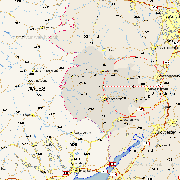
Herefordshire Map Showing Location of Evesbatch
Population: 63
Easting: 369202 Northing: 248474
Latitude: 52.13 Longitude: -2.45
 = Evesbatch
Easting: 369202 Northing: 248474
Latitude: 52.13 Longitude: -2.45
= Evesbatch
This Evesbatch map below is supplied by Google. Use the tools in the top left corner to zoom into street level or zoom out for a road map, you may also need to zoom in to see Evesbatch on the map. Click and drag the map to move around. If the map fails to load try and refresh your browser or zoom in or out (+ or -).
Update - it seems Google no longer allow people to use their maps for free! This Evesbatch map sometimes loads and sometimes gives a error. I am working on a solution.
Closest 30 Towns or Cities to Evesbatch (Population over 500)
Bosbury 5.56km Bromyard 6.52km Colwall 7.19km Cradley 8.12km Ledbury 9.54km Whitbourne 9.88km Withington 13.05km Much Marcle 15.21km Lugwardine 15.54km Mordiford 15.58km Bodenham 16.03km Sutton 16.36km Fownhope 18.02km Moreton 19.7km Moreton on Lugg 19.7km Moreton-on-Lugg 19.7km Hereford 20.44km Wellington 20.48km Upton Bishop 20.89km Bullingham 21.35km Burghill 21.94km Leominster 22.29km Credenhill 24.18km Weston 24.75km Weston under Penyard 24.75km Weston-under-Penyard 24.75km Brimfield 25.17km Luston 25.26km Ross 25.37km Ross-on-wye 25.37km