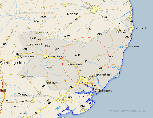
Suffolk Map Showing Location of Debenham
Population: 1746
Area Size (ha): 59
District: Mid Suffolk
Easting: 617431 Northing: 262430
Latitude: 52.22 Longitude: 1.18
 = Debenham
Area Size (ha): 59
District: Mid Suffolk
Easting: 617431 Northing: 262430
Latitude: 52.22 Longitude: 1.18
= Debenham
This Debenham map below is supplied by Google. Use the tools in the top left corner to zoom into street level or zoom out for a road map, you may also need to zoom in to see Debenham on the map. Click and drag the map to move around. If the map fails to load try and refresh your browser or zoom in or out (+ or -).
Update - it seems Google no longer allow people to use their maps for free! This Debenham map sometimes loads and sometimes gives a error. I am working on a solution.
Closest 30 Towns or Cities to Debenham (Population over 500)
Debenham 0km Worlingworth 7.18km Thorndon 8.15km Otley 8.16km Mendlesham 8.76km Dennington 9.7km Framlingham 10.22km Coddenham 10.33km Eye 11.35km Henley 11.35km Old Newton 11.35km Stradbroke 12.48km Bacton 12.64km Gislingham 12.97km Wirnesham 12.98km Witnesham 12.98km Haughley 13.62km Grundisburgh 13.75km Stowmarket 14.13km Great Blakenham 14.17km Wickham Market 14.53km Hoxne 14.86km Ipswich 14.88km Claydon 15.52km Laxfield 15.54km Somersham 15.85km Woodbridge 15.85km Melton 15.85km Ufford 15.9km Ringshall 16.49km