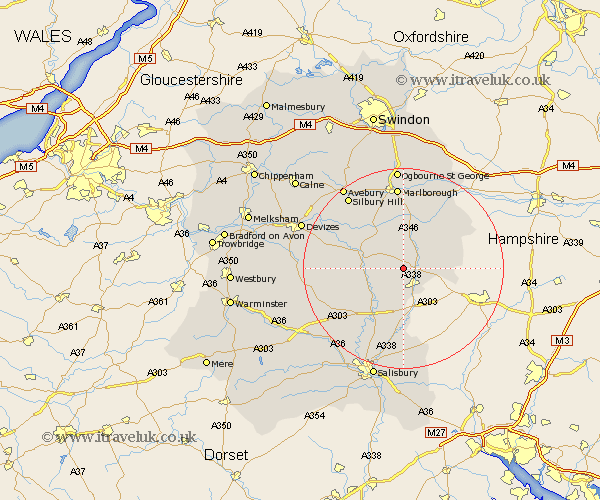
Wiltshire Map Showing Location of Everleigh
Population: 230
District: Kennet
Easting: 420927 Northing: 152048
Latitude: 51.27 Longitude: -1.7
 = Everleigh
District: Kennet
Easting: 420927 Northing: 152048
Latitude: 51.27 Longitude: -1.7
= Everleigh
This Everleigh map below is supplied by Google. Use the tools in the top left corner to zoom into street level or zoom out for a road map, you may also need to zoom in to see Everleigh on the map. Click and drag the map to move around. If the map fails to load try and refresh your browser or zoom in or out (+ or -).
Update - it seems Google no longer allow people to use their maps for free! This Everleigh map sometimes loads and sometimes gives a error. I am working on a solution.
Closest 30 Towns or Cities to Everleigh (Population over 500)
Collingbourne Ducis 3.94km North Tidworth 4.38km Tidworth 4.38km Netheravon 6.89km Enford 7.2km Burbage 7.76km Figheldean 8.03km Pewsey 8.18km Lugershall 8.19km Ludgershall 8.19km Upavon 8.32km Grafton 8.74km Bulford 8.75km Durrington 10.37km Lark Hill 12.33km Amesbury 12.54km Great Bedwyn 13.11km Bedwyn 13.11km Shalbourn 13.95km Shalbourne 13.95km Idmiston 14.88km Urchfont 16.64km Marlborough 16.72km Shrewton 16.73km Winterbourne Dauntsey 18.86km Winterbourne 18.86km Ramsbury 19.78km Lavington 19.79km Market Lavington 19.79km Winterslow 20.52km