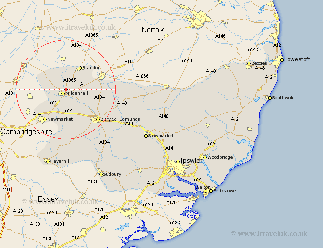
Suffolk Map Showing Location of Eriswell
Population: 4438
District: Forest Heath
Easting: 572459 Northing: 277357
Latitude: 52.37 Longitude: 0.53
 = Eriswell
District: Forest Heath
Easting: 572459 Northing: 277357
Latitude: 52.37 Longitude: 0.53
= Eriswell
This Eriswell map below is supplied by Google. Use the tools in the top left corner to zoom into street level or zoom out for a road map, you may also need to zoom in to see Eriswell on the map. Click and drag the map to move around. If the map fails to load try and refresh your browser or zoom in or out (+ or -).
Update - it seems Google no longer allow people to use their maps for free! This Eriswell map sometimes loads and sometimes gives a error. I am working on a solution.
Closest 30 Towns or Cities to Eriswell (Population over 500)
Mildenhall 2.18km Lakenheath 7.74km Lake Heath 7.74km Brandon 10.85km Gazeley 13.03km Risby 13.03km Moulton 13.42km Barnham 13.58km Newmarket 15.21km Barrow 15.22km Fornham All Saints 15.87km Exning 16.7km Troston 17.87km Bury St. Edmunds 17.99km Bury Saint Edmunds 17.99km Bury St Edmunds 17.99km Honington 18.49km Great Barton 19.37km Chevington 19.38km Chedburgh 21.16km Ixworth 21.69km Bardwell 22.22km Rushbrooke 23.02km Thurston 23.23km Pakenham 23.23km Wickhambrook 24.2km Barningham 24.97km Stanton 25.52km Bradfield St. George 25.94km Bradfield 25.94km