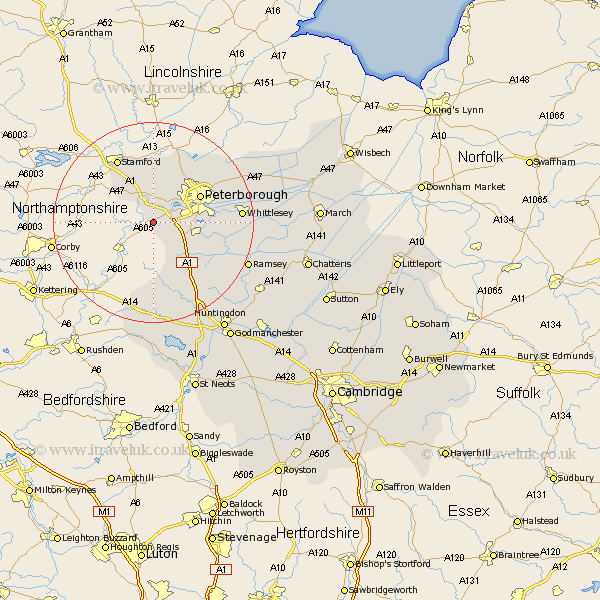
Cambridgeshire Map Showing Location of Elton
Population: 726
District: Huntingdonshire
Easting: 509647 Northing: 294094
Latitude: 52.53 Longitude: -0.38
 = Elton
District: Huntingdonshire
Easting: 509647 Northing: 294094
Latitude: 52.53 Longitude: -0.38
= Elton
This Elton map below is supplied by Google. Use the tools in the top left corner to zoom into street level or zoom out for a road map, you may also need to zoom in to see Elton on the map. Click and drag the map to move around. If the map fails to load try and refresh your browser or zoom in or out (+ or -).
Update - it seems Google no longer allow people to use their maps for free! This Elton map sometimes loads and sometimes gives a error. I am working on a solution.
Closest 30 Towns or Cities to Elton (Population over 500)
Castor 5.02km Orton Waterville 5.93km Folksworth 7.92km Wittering 8.68km Stilton 8.76km Barnack 9.34km Yaxley 9.75km Helpston 9.87km Helpstone 9.87km Farcet 10.15km Petersborough 10.59km Peterborough 10.59km Peterbrough 10.59km Holme 12.57km Glinton 13.01km Sawtry 13.64km Newborough 14.59km Northborough 14.63km Eye 15.42km Whittlesey 17.01km Alconbury 20.14km Ramsey 20.29km Thorney 21.27km Spaldwick 22.5km Bury 23.16km Wistow 24.25km Ellington 25.02km Kimbolton 25.94km Huntingdon 26.05km Warboys 26.07km