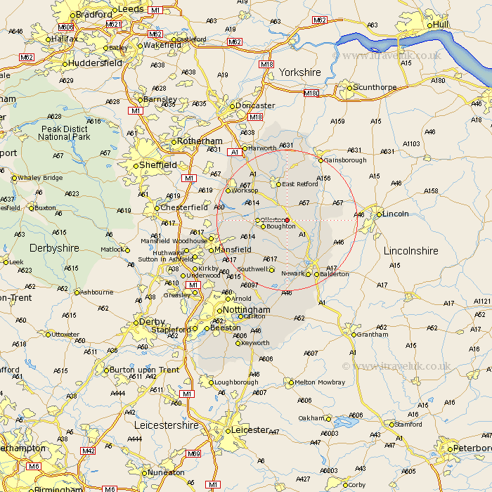
Nottinghamshire Map Showing Location of Egmanton
Population: 254
District: Newark and Sherwood
Easting: 473442 Northing: 369445
Latitude: 53.22 Longitude: -0.9
 = Egmanton
District: Newark and Sherwood
Easting: 473442 Northing: 369445
Latitude: 53.22 Longitude: -0.9
= Egmanton
This Egmanton map below is supplied by Google. Use the tools in the top left corner to zoom into street level or zoom out for a road map, you may also need to zoom in to see Egmanton on the map. Click and drag the map to move around. If the map fails to load try and refresh your browser or zoom in or out (+ or -).
Update - it seems Google no longer allow people to use their maps for free! This Egmanton map sometimes loads and sometimes gives a error. I am working on a solution.
Closest 30 Towns or Cities to Egmanton (Population over 500)
Tuxford 1.11km East Markham 3.87km Markham 3.87km Walesby 5.85km Boughton 6.49km Elksley 7.11km Elkesley 7.11km Ollerton 7.77km Grove 9.26km East Retford 11.34km Bampton 11.4km Rampton 11.4km Edwinstowe 11.71km North Leverton 12.42km Muskham 12.43km North Muskham 12.43km Collingham 12.45km North Collingham 12.45km Bilsthorpe 12.84km Clipstone 14.44km Hayton 14.82km Clarborough 14.82km Winthorpe 15.13km Farnsfield 15.73km Southwell 15.75km Sutton 15.82km Warsop 16.75km Newark on Trent 17.58km Newark upon Trent 17.58km Newark 17.58km