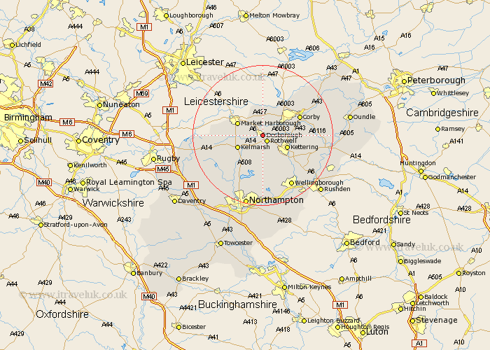
Northamptonshire Map Showing Location of Desborough
Population: 7209
Area Size (ha): 186
District: Kettering
Easting: 480440 Northing: 282402
Latitude: 52.43 Longitude: -0.82
 = Desborough
Area Size (ha): 186
District: Kettering
Easting: 480440 Northing: 282402
Latitude: 52.43 Longitude: -0.82
= Desborough
This Desborough map below is supplied by Google. Use the tools in the top left corner to zoom into street level or zoom out for a road map, you may also need to zoom in to see Desborough on the map. Click and drag the map to move around. If the map fails to load try and refresh your browser or zoom in or out (+ or -).
Update - it seems Google no longer allow people to use their maps for free! This Desborough map sometimes loads and sometimes gives a error. I am working on a solution.
Closest 30 Towns or Cities to Desborough (Population over 500)
Desborough 0km Rothwell 2.16km Rowell 2.16km Wilbarston 5.67km Cottingham 7.16km Kettering 7.73km Broughton 8.15km Geddington 9.04km Clipston 9.23km Walgrave 11.12km Caldecott 11.48km Corby 11.58km Stanion 11.89km Isham 12.19km Naseby 12.6km Weldon 13.61km Burton Latimer 13.76km Brixworth 14.15km Brigstock 14.8km Gretton 15.06km Pitsford 15.5km Spratton 15.81km Welford 15.93km Overstone 16.68km Finedon 16.69km Guilsborough 16.69km Wellingborough 16.81km Sywell 16.83km Moulton 16.83km Boughton 17.61km