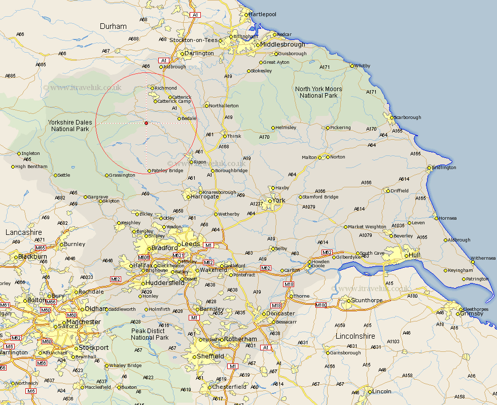
Yorkshire Map Showing Location of East Witton
Population: 258
District: Richmondshire
Easting: 415195 Northing: 485714
Latitude: 54.27 Longitude: -1.77
 = East Witton
District: Richmondshire
Easting: 415195 Northing: 485714
Latitude: 54.27 Longitude: -1.77
= East Witton
This East Witton map below is supplied by Google. Use the tools in the top left corner to zoom into street level or zoom out for a road map, you may also need to zoom in to see East Witton on the map. Click and drag the map to move around. If the map fails to load try and refresh your browser or zoom in or out (+ or -).
Update - it seems Google no longer allow people to use their maps for free! This East Witton map sometimes loads and sometimes gives a error. I am working on a solution.
Closest 30 Towns or Cities to East Witton (Population over 500)
Middleham 3.73km Leyburn 4.92km Masham 9.4km Crakehall 10.42km Grewelthorpe 11.98km Bedale 12.05km Kirkby Malzeard 13.46km Catterick 14.08km Bradley 14.14km West Tanfield 14.97km Tanfield 14.97km Richmond 14.98km Scorton 16.88km Gilling 18.81km Bewerley 20.39km North Cowton 20.42km Middleton Tyas 21.74km East Cowton 22.52km Cowton 22.52km Northallerton 22.86km Ripon 23.3km Barton 23.49km Dacre 24.32km Brompton 24.52km Melsonby 24.68km Dishforth 26.2km Darley 26.31km Grassington 26.34km Topcliffe 26.59km Monkton 26.78km