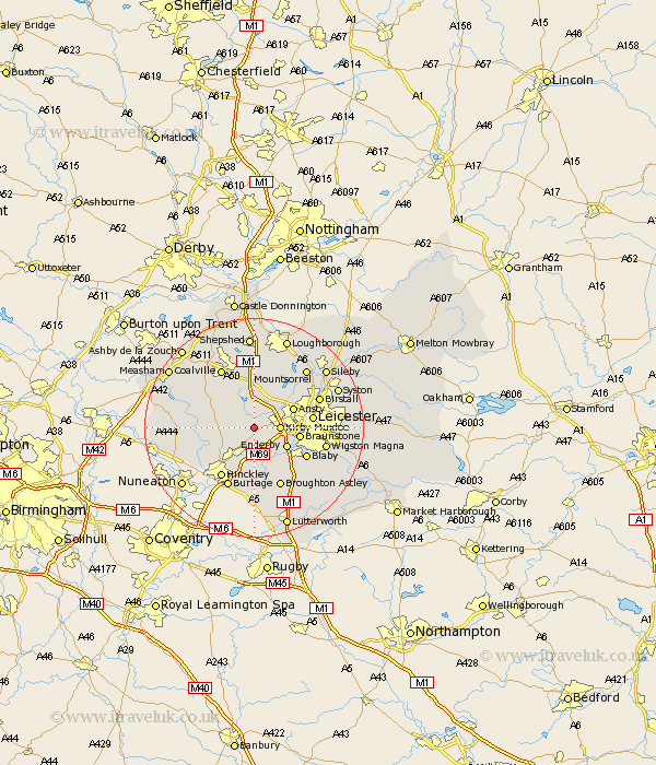
Leicestershire Map Showing Location of Desford
Population: 3129
Area Size (ha): 73
District: Hinckley and Bosworth
Easting: 448515 Northing: 302383
Latitude: 52.62 Longitude: -1.28
 = Desford
Area Size (ha): 73
District: Hinckley and Bosworth
Easting: 448515 Northing: 302383
Latitude: 52.62 Longitude: -1.28
= Desford
This Desford map below is supplied by Google. Use the tools in the top left corner to zoom into street level or zoom out for a road map, you may also need to zoom in to see Desford on the map. Click and drag the map to move around. If the map fails to load try and refresh your browser or zoom in or out (+ or -).
Update - it seems Google no longer allow people to use their maps for free! This Desford map sometimes loads and sometimes gives a error. I am working on a solution.
Closest 30 Towns or Cities to Desford (Population over 500)
Desford 0km Newbold Verdon 3.37km Kirby Muxloe 4.5km Bagworth 5.01km Markfield 5.56km Barlestone 5.92km Enderby 6.74km Elmesthorpe 7.5km Elmsthorpe 7.5km Anstey 7.7km Ansty 7.7km Market Bosworth 7.88km Narborough 7.91km Braunstone 8.09km Croft 8.15km Whetstone 8.75km Stoney Stanton 9.34km Ibstock 9.64km Stoke Golding 9.64km Cosby 10.03km Leiscester 10.29km Leicester 10.29km Blaby 10.58km Shackerstone 10.78km Hinckley 10.85km Sharnford 11.12km Sapcote 11.18km Heather 11.65km Broughton Astley 12km Burbage 12km