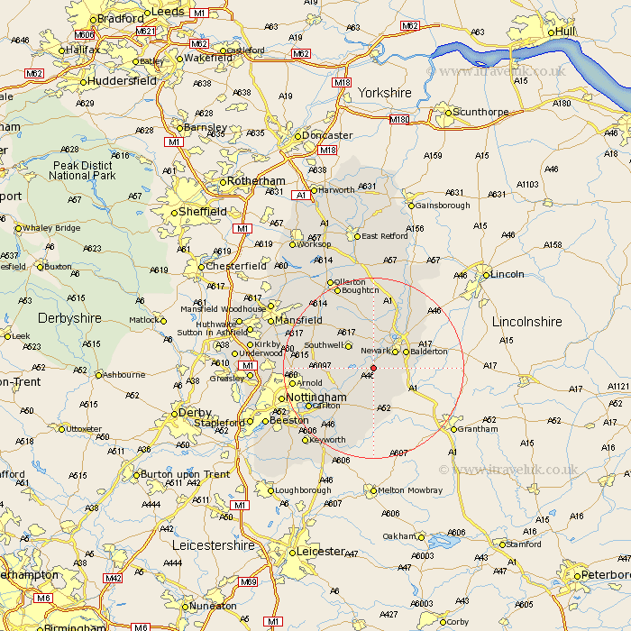
Nottinghamshire Map Showing Location of East Stoke
Population: 143
District: Newark and Sherwood
Easting: 474873 Northing: 349063
Latitude: 53.03 Longitude: -0.88
 = East Stoke
District: Newark and Sherwood
Easting: 474873 Northing: 349063
Latitude: 53.03 Longitude: -0.88
= East Stoke
This East Stoke map below is supplied by Google. Use the tools in the top left corner to zoom into street level or zoom out for a road map, you may also need to zoom in to see East Stoke on the map. Click and drag the map to move around. If the map fails to load try and refresh your browser or zoom in or out (+ or -).
Update - it seems Google no longer allow people to use their maps for free! This East Stoke map sometimes loads and sometimes gives a error. I am working on a solution.
Closest 30 Towns or Cities to East Stoke (Population over 500)
Elston 2.16km Fiskerton Ferry 2.17km Fiskerton 2.17km Farndon 2.9km Bleasby 3.34km Flintham 5.67km Newark 5.8km Newark upon Trent 5.8km Newark on Trent 5.8km Newark-on-Trent 5.8km Southwell 7.27km Balderton 7.65km East Bridgford 8.65km Winthorpe 9.98km Muskham 10.29km North Muskham 10.29km Coddington 10.5km Aslocton 11.12km Aslockton 11.12km Burton Joyce 11.47km Shelford 11.6km Bingham 11.98km Oxton 12.4km Woodborough 12.4km Farnsfield 12.47km Calverton 13.37km Claverton 13.37km Lambley 13.47km Cropwell 14.59km Cropwell Butler 14.59km