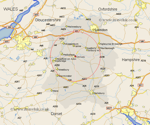
Wiltshire Map Showing Location of Devizes
Population: 13000
Area Size (ha): 407
District: Kennet
Easting: 401160 Northing: 161269
Latitude: 51.35 Longitude: -1.98
 = Devizes
Area Size (ha): 407
District: Kennet
Easting: 401160 Northing: 161269
Latitude: 51.35 Longitude: -1.98
= Devizes
This Devizes map below is supplied by Google. Use the tools in the top left corner to zoom into street level or zoom out for a road map, you may also need to zoom in to see Devizes on the map. Click and drag the map to move around. If the map fails to load try and refresh your browser or zoom in or out (+ or -).
Update - it seems Google no longer allow people to use their maps for free! This Devizes map sometimes loads and sometimes gives a error. I am working on a solution.
Closest 30 Towns or Cities to Devizes (Population over 500)
Roundway 1.86km Bishops Cannings 2.97km Rowde 3.47km Potterne 4.37km Urchfont 6.56km Worton 6.87km Seend 6.94km Lavington 7.42km Market Lavington 7.42km Cherhill 7.77km Calne 9.33km Erlestoke 9.41km Melksham 10.58km Lacock 10.8km Laycock 10.8km West Lavington 11.18km Semington 11.58km Bremhill 11.65km Steeple Ashton 11.81km Edington 12.31km Hilmarton 13.03km Hillmarton 13.03km Bratton 13.1km Upavon 13.75km Broughton Gifford 14.01km Hilperton 14.38km Chippenham 14.46km Holt 15.05km Bradford on Avon 15.16km Bradford-on-Avon 15.16km