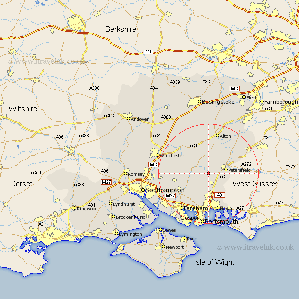
Hampshire Map Showing Location of East Meon
Population: 1116
District: East Hampshire
Easting: 467848 Northing: 120937
Latitude: 50.98 Longitude: -1.03
 = East Meon
District: East Hampshire
Easting: 467848 Northing: 120937
Latitude: 50.98 Longitude: -1.03
= East Meon
This East Meon map below is supplied by Google. Use the tools in the top left corner to zoom into street level or zoom out for a road map, you may also need to zoom in to see East Meon on the map. Click and drag the map to move around. If the map fails to load try and refresh your browser or zoom in or out (+ or -).
Update - it seems Google no longer allow people to use their maps for free! This East Meon map sometimes loads and sometimes gives a error. I am working on a solution.
Closest 30 Towns or Cities to East Meon (Population over 500)
Froxfield 4.39km West Meon 5.1km Clanfield 6.03km Buriton 6.12km Petersfield 7.24km Corhampton 7.24km Hambledon 7.77km Steep 7.92km Droxford 7.92km Bramdean 8.06km Horndean 8.19km Soberton 8.94km Ropley 9.91km Liss 10.86km Swanmore 10.87km Greatham 11.92km Cheriton 11.92km Rowlands Castle 12.56km Shidfield 12.85km Shedfield 12.85km Waterloo 13.02km Waterlooville 13.02km Selborne 13.14km Wickham 13.16km Bishops Waltham 13.36km Bishop's Waltham 13.36km Upper Farringdon 13.44km Faringdon 13.44km Farringdon 13.44km Waltham Chase 13.83km